Data Relationships
This image was an earlier version of this project's main data structure:
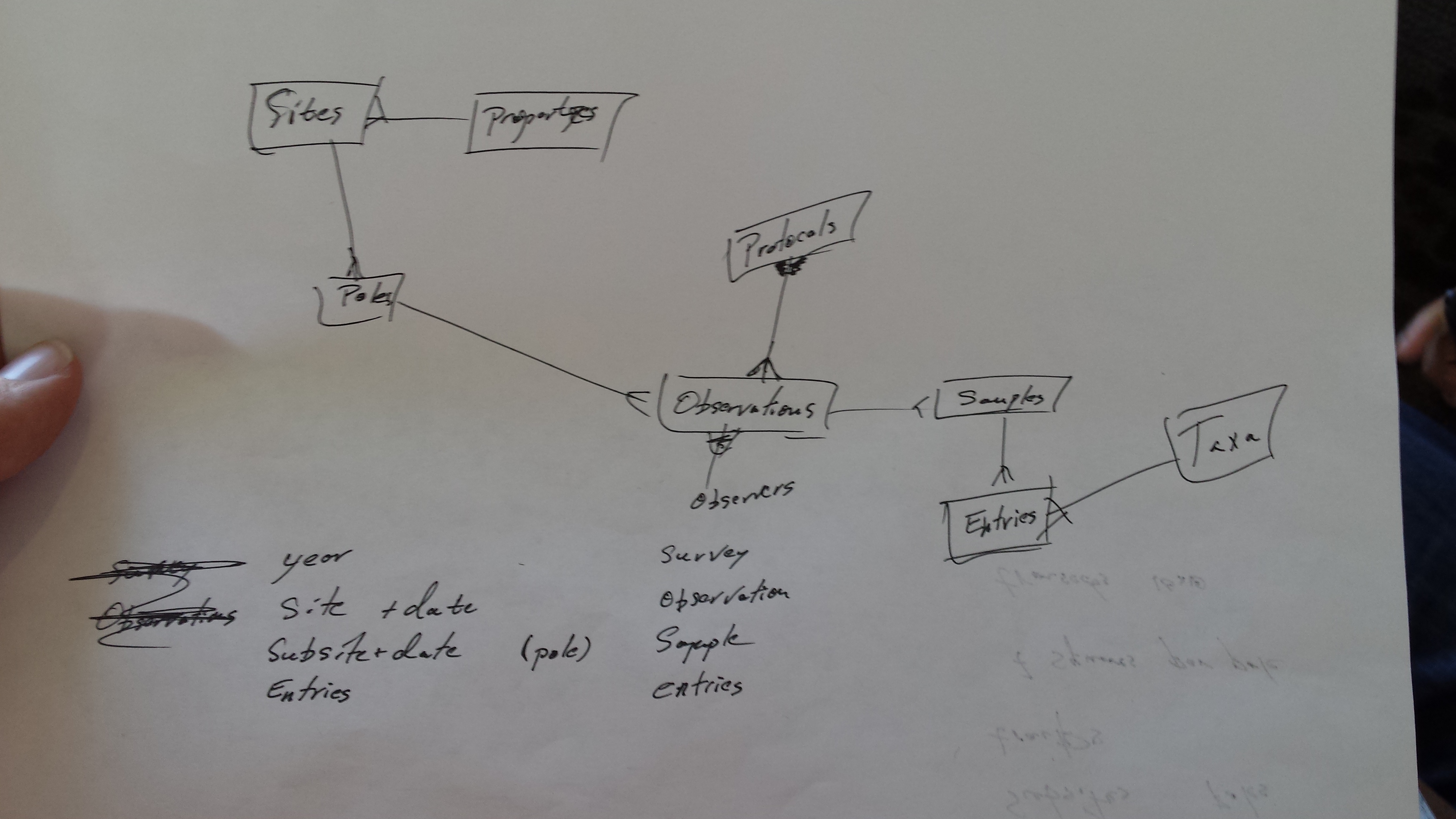
Property here is a batch of land which that has one owner or manager. We may in the future want to add information about that owner or manager, but we don't have any use for that info at the current time. A property can be then broken down in to sites. As an example, a state park that's a few square miles in size might be too big to meaningfully survey. In that case, the Property would have the name of the state part, and the Sites that belong to that Property might be "Park Campground Area" or "West Lot I". That said, many properties will have only one site.
One key difference between the above image and the current application is that Sites which can have many Subsites, unlike the picture which uses the name "Poles". Subsites refer to a specific place observations are taken so that the observations can then be compared year-over-year. For bird survey protocols, the observer often stands in a specific spot and looks for birds, and at Virginia Working Landscapes those specific spots are sometimes called "poles". For plant survey protocols, the observer may have a patch of land to count all the plants in, sometimes called a "transect". This application currently makes no distinction between poles and transects, and lumps them all together as Subsites.